National Recreation Area

Delaware Water Gap National Recreation Area

Delaware Water Gap National Recreation Area is a National Recreation Area in New Jersey, Pennsylvania. The NPS currently lists 3 active alerts (2 closures), 6 campgrounds and 2 visitor centers, and no entrance fee.

New JerseyPennsylvania National Recreation Area No entrance fee

Updated · NPS Data API

A waterfall flows toward the viewer along a rocky riverbed.
Fulmer Falls · Photo: NPS Photo (via nps.gov)

About the park

“Situated within the most densely populated region of the United States, Delaware Water Gap National Recreation Area provides a unique opportunity to experience tranquil landscapes, rich human history, and striking scenery along 40 miles of the longest free-flowing river east of the Mississippi.”

Active alerts

3

Closures

2

Campgrounds

6

Visitor centers

2

Current alerts and closures

3 active NPS alerts as of Oct 28, 2026: 2 closures, 0 danger, 0 caution and 1 information.

Closure

Dingmans Falls Trail, Road, and Access Closed for Bridge Replacement

Dingmans Falls site is closed for a bridge replacement project and trail rehabilitation. All traffic, including pedestrian, cyclist, and vehicle traffic, is prohibited on the road and trail during construction.

Posted or updated Jul 28, 2026 ·Details on nps.gov

Closure

Old Mine Road North Construction Closure Begins April 6, 2026

Old Mine Road between Jager Road and Route 206 will close to all traffic beginning on April 6, 2026. Contractors will work to rehabilitate a 3.5-mile stretch of road. The construction area will be closed to all traffic for the safety of park visitors and contractors.

Posted or updated Apr 21, 2026 ·Details on nps.gov

Information

Main Street Walpack Bridge Closed Until Further Notice

Main Street in Walpack Center is closed at the Flatbrook Bridge due to structural damage to the bridge.

Posted or updated May 13, 2025 ·Park conditions on nps.gov

Entrance fees and passes

This site has no entrance fee, according to NPS fee data.Parking or transportation fees may apply.

Entrance fees
FeeCostDetails
Entrance - Private Vehicle$10Entrance fee for beaches and boat launches. Fee is good for one vehicle and it's passengers (up to 7 people).
Park passes
PassCostBuy
Annual Entrance - Park$45At the park

Things to do

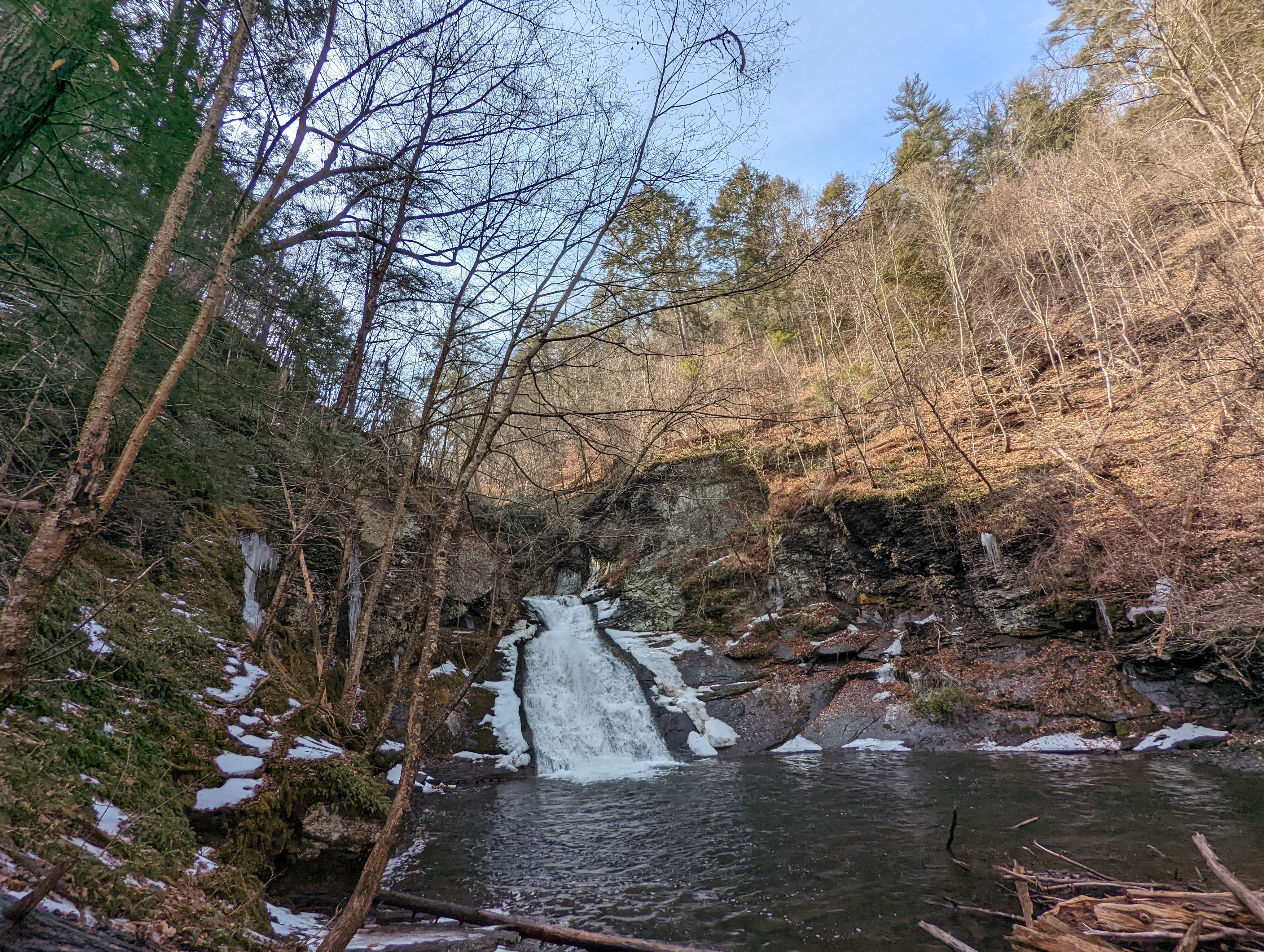
A small, tiered waterfall and pool with a small amount of snow around it.
Photo: NPS Photo/ J. Grier

Easy Hike Along Hornbecks Creek

An easy, one-mile out and back hike along the Lower Hornbecks Creek will lead visitors to a small waterfall, but the waterfall is only part of the view!

Pets allowed

Hiking

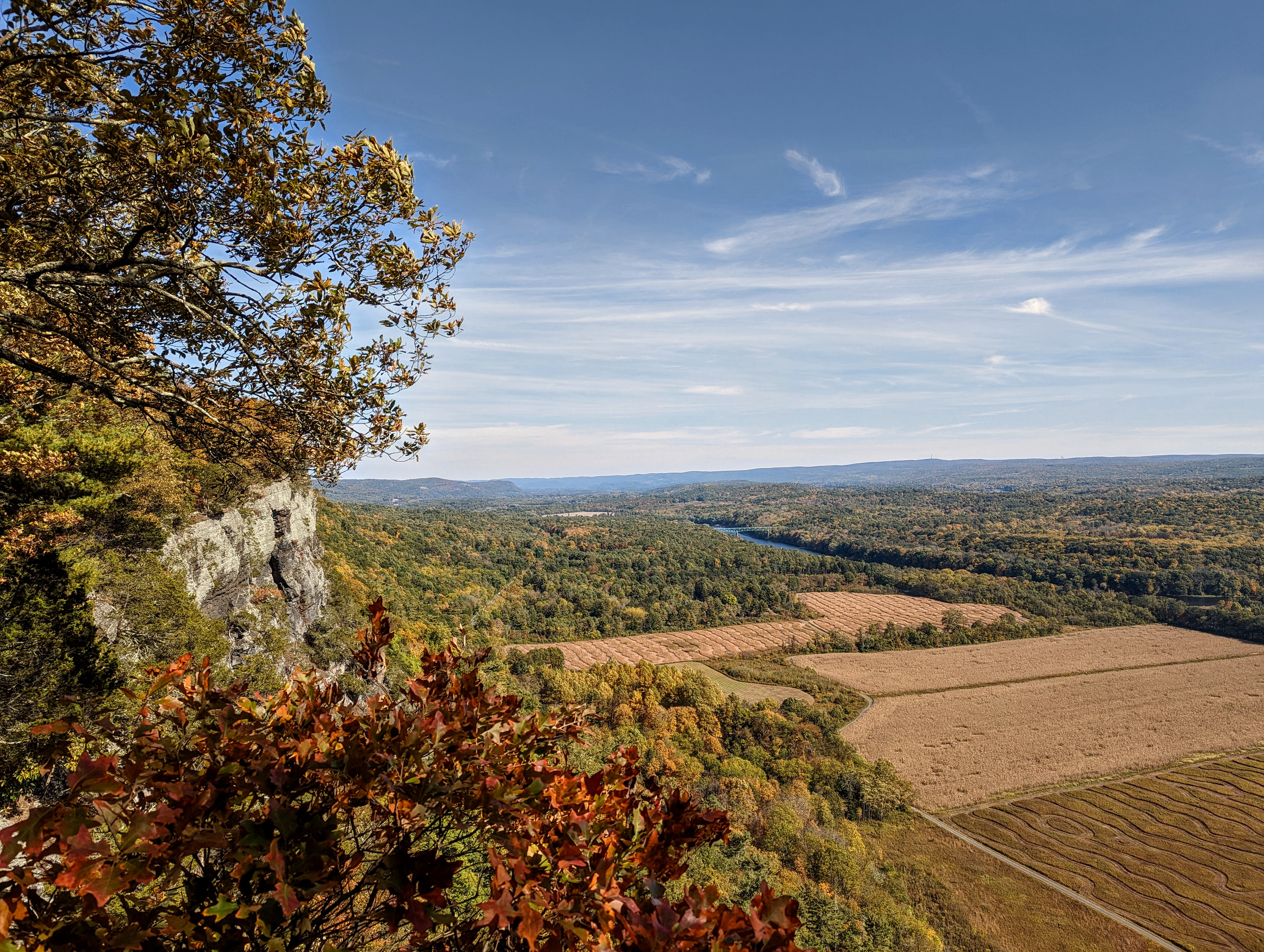
A view from the Cliff Trail. The Raymonskill ridge hovering over the river and farmfields below.
Photo: NPS Photo/ J. Grier

Hike the Cliff Trail

The Cliff Trial along the Raymondskill Ridge has gorgeous scenic views and just enough elevation gain to get the heart pumping.

1-4 Hours Year-round Pets allowed

Front-Country Hiking

See all 6 things to do in Delaware Water Gap →

Activities the NPS lists for Delaware Water Gap.

Arts and CultureAuto and ATVScenic DrivingBikingBoatingCampingBackcountry CampingCanoe or Kayak CampingCar or Front Country CampingGroup CampingRV CampingClimbingFishingFreshwater FishingFly FishingFoodPicnickingGuided ToursHikingHorse TrekkingHorseback RidingHunting and GatheringHuntingPaddlingCanoeingKayakingJunior Ranger ProgramSkiingCross-Country SkiingSnowshoeingSwimmingFreshwater SwimmingWildlife WatchingBirdwatchingMuseum ExhibitsShoppingBookstore and Park Store

Operating hours

Park roads are open 24-hours a day. Most day-use areas within the park are open sunrise to sunset (such as trailhead parking lots, Millbrook Village, and all picnic areas).

Delaware Water Gap National Recreation Area
DayHours
MondayAll Day
TuesdayAll Day
WednesdayAll Day
ThursdayAll Day
FridayAll Day
SaturdayAll Day
SundayAll Day

Weather: Spring: Temperatures usually range from lows of 26 F to highs of 80 F with average rainfall of 5 inches. Summer: Temperatures usually range from lows of 55 F to highs of 85 F with average rainfall of 4 inches.

Contact and directions

Phone
5704262452
Email
[email protected]
Address
1978 River Road, Bushkill, PA 18324
Coordinates
41.1279, -74.9475· View on OpenStreetMap

Official park page on nps.gov Directions

Visitor centers

Visitor centerStandard hoursPhonePassport stamp
Bushkill Meeting CenterMon 9:00AM - 4:00PM · Tue Closed · Wed Closed · Thu Closed · Fri 9:00AM - 4:00PM · Sat 9:00AM - 4:00PM · Sun 9:00AM - 4:00PM570-426-2452Yes
Kittatinny Point Visitor CenterMon 9:00AM - 4:00PM · Tue Closed · Wed Closed · Thu Closed · Fri 9:00AM - 4:00PM · Sat 9:00AM - 4:00PM · Sun 9:00AM - 4:00PM—Yes

Campgrounds

Site counts and fees are from the NPS campground data. Fees show the first listed rate; availability is not shown here — check the reservation site.

On Amazon

Popular trail picks

As an Amazon Associate I earn from qualifying purchases.

More parks in New Jersey

Appalachian National Scenic TrailEllis Island Part of Statue of Liberty National MonumentGateway National Recreation AreaGreat Egg Harbor RiverLower Delaware National Wild and Scenic RiverMorristown National Historical ParkNew Jersey Pinelands National ReservePaterson Great Falls National Historical ParkThomas Edison National Historical ParkWashington-Rochambeau Revolutionary Route National Historic TrailAll in New Jersey

Nearest other NPS sites

Sources

  • Park details, alerts, fees and passes, visitor centers and campgrounds: National Park Service Data API, snapshot of Oct 28, 2026.
  • Official park page: https://www.nps.gov/dewa/index.htm
  • Data: National Park Service (NPS) Data API, U.S. Department of the Interior (developer.nps.gov). This product uses the NPS Data API but is not endorsed or certified by the National Park Service. The National Park Service and the U.S. Department of the Interior do not endorse OpenParks. Photos are NPS images shown with their original credits; park descriptions are short excerpts credited to the NPS. Always confirm current conditions on nps.gov before you travel.